


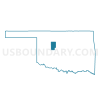
Voting District 16, Blaine County, Oklahoma
About
Outline

Summary
| Unique Area Identifier | 653522 |
| Name | Voting District 16 |
| County | Blaine County |
| State | Oklahoma |
| Area (square miles) | 99.03 |
| Land Area (square miles) | 99.03 |
| Water Area (square miles) | 0.00 |
| % of Land Area | 100.00 |
| % of Water Area | 0.00 |
| Latitude of the Internal Point | 35.75406110 |
| Longtitude of the Internal Point | -98.40766880 |
Maps


Graphs
Select a template below for downloading or customizing gragh for Voting District 16, Blaine County, Oklahoma


Neighbors
Neighoring Voting District (by Name) Neighboring Voting District on the Map
- Voting District 10, Blaine County, OK
- Voting District 11, Blaine County, OK
- Voting District 12, Blaine County, OK
- Voting District 17, Blaine County, OK
- Voting District 20, Blaine County, OK
- Voting District 23, Custer County, OK
- Voting District 302, Kingfisher County, OK
- Voting District 406, Canadian County, OK
- Voting District 500, Canadian County, OK
Top 10 Neighboring County Subdivision (by Population) Neighboring County Subdivision on the Map
- Watonga CCD, Blaine County, OK (6,744)
- Okarche-Cashion CCD, Kingfisher County, OK (2,690)
- Geary CCD, Blaine County, OK (1,937)
- Thomas CCD, Custer County, OK (1,715)
- West Canadian CCD, Canadian County, OK (1,559)
Top 10 Neighboring Place (by Population) Neighboring Place on the Map
Top 10 Neighboring Unified School District (by Population) Neighboring Unified School District on the Map
- Watonga Public Schools, OK (6,084)
- Thomas-Fay-Custer Unified Schools, OK (2,690)
- Geary Public Schools, OK (2,106)
- Calumet Public Schools, OK (999)
- Lomega Public Schools, OK (727)
Top 10 Neighboring State Legislative District Lower Chamber (by Population) Neighboring State Legislative District Lower Chamber on the Map
Top 10 Neighboring State Legislative District Upper Chamber (by Population) Neighboring State Legislative District Upper Chamber on the Map
- State Senate District 22, OK (98,783)
- State Senate District 23, OK (80,676)
- State Senate District 38, OK (70,224)
Top 10 Neighboring 111th Congressional District (by Population) Neighboring 111th Congressional District on the Map
Top 10 Neighboring Census Tract (by Population) Neighboring Census Tract on the Map
- Census Tract 9610, Custer County, OK (3,356)
- Census Tract 9584, Kingfisher County, OK (2,690)
- Census Tract 3001, Canadian County, OK (2,469)
- Census Tract 9590, Blaine County, OK (1,937)
- Census Tract 9588, Blaine County, OK (1,220)
Top 10 Neighboring 5-Digit ZIP Code Tabulation Area (by Population) Neighboring 5-Digit ZIP Code Tabulation Area on the Map
- 73750, OK (7,025)
- 73772, OK (6,119)
- 73040, OK (1,976)
- 73669, OK (1,675)
- 73014, OK (1,431)
- 73646, OK (384)
- 73764, OK (144)
- 73043, OK (125)